Cameron’s Cartography
For most Historians, maps are just tools to show place, movement, and topography. Thanks to Dr. Meghan Kelly this historian now knows that they can be so, so much more. Maps can be used to show emotion, place, connections, and power. They can also tear and rebuild experiences, break traditional norms, and elevate silenced voices.
This portfolio is a memorialization of my journey to better understand the power of mapping and reconceptualize space, time, and realities.
Benidict Arnold Maps

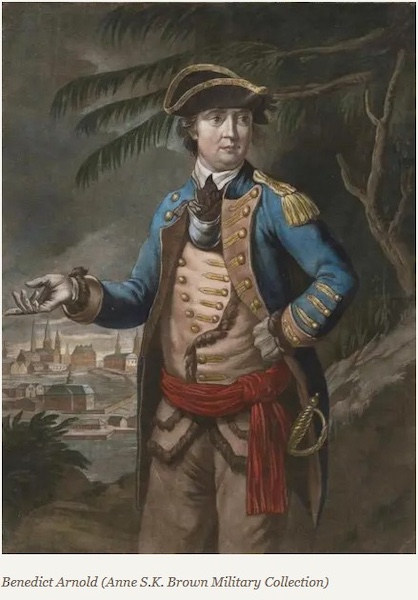
Historical Markers and Memory: General Benedict Arnold America’s Antihero
When one looks at how Benidict Arnold is presented and contextualized in monuments, observers may see that he is not only depicted in greater frequency as an American traitor, but because of his eventual defeat by the country he once served, has been memorialized as a reminder that individual greatness cannot undermine American ideals and traitors will be ultimately defeated.
Maps and Data
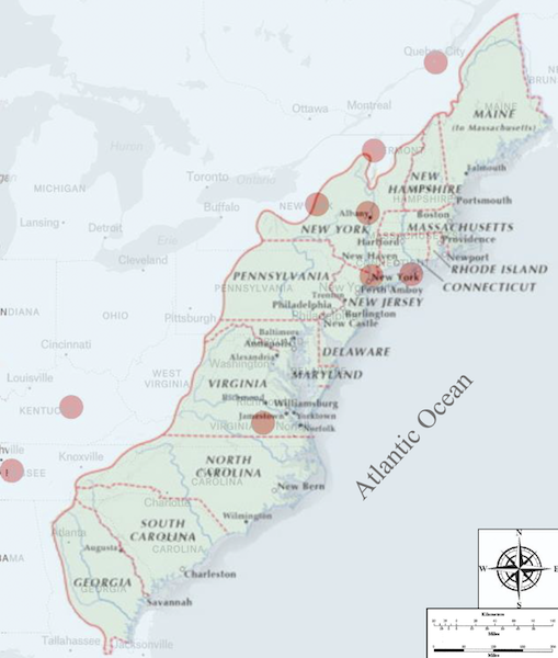
Benedict Arnold Battle Sites and the Original 13 American Colonies
This map shows Gen. Benidict Arnold’s ten major battles as a soldier fighting first for the independence of the American colonies and then for the British Empire during the American Revolutionary War. It also shows the continental scope of the revolutionary conflict, and the location of the rebelling thirteen colonies.
When it was created, I was hoping that it would become the foundation for future maps and a vehicle to add detail to Arnold battle locations; monuments; today’s cities, towns, roads, and national parks; populations; and messaging related to how Arnold has become to be seen in 2024 as an American anti-hero.
Map | Reflection
Benedict Arnold: From American General to British General in Eleven Steps
Benedict Arnold, born in 1741, has come to be known as one of the United States’ most notorious traitors. But before switching his allegiance to the British, he was a revolutionary hero. These eleven maps show each one of his major battles as an American and British general in addition to his attempt to turn West Point over to the British Army.
Map | Reflection
Ona Judge Maps
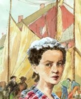
Ona Judge: Freedom Regained
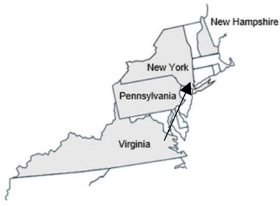
Ona Judge – born around 1773 at Mount Vernon, Washington’s plantation in Virginia – was a mixed raced woman who regained her freedom by escaping from slavery and defying one of the most powerful figures of her time, President George Washington. This map of 1796 Philadelphia shows Richard Allen’s support, Ona’s journey from the president’s house, time in hiding, Washington’s attempt to recapture her, and her journey to Portsmouth, New Hampshire.
Map | Reflection
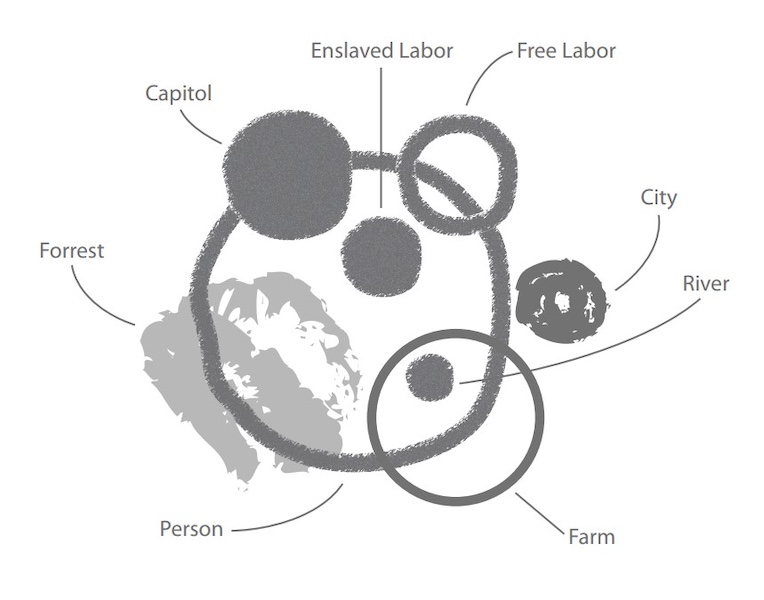
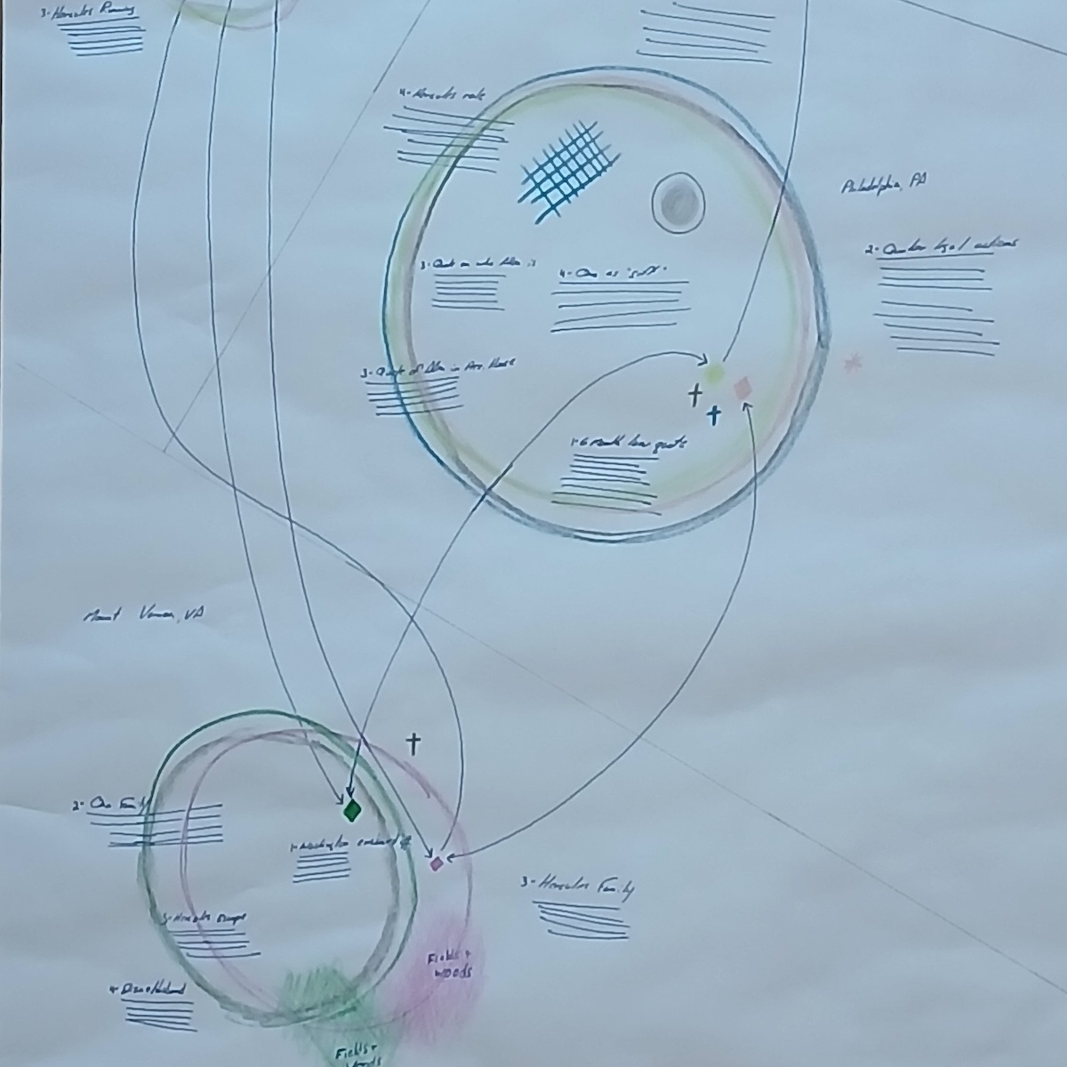
Ona Judge’s Topology and Relationships
The goal of this map is designed to explore the topologies and relationships related to Ona Judge’s quest for freedom; George Washington’s diminishing power over her; and their positions at Mount Vernon, Philadelphia, New York, and Portsmouth. The final product is a relational map that relies on circular symbology with a spectrum of colors representing Judge and Washington within multiple locations.
Map | Reflection
Ona Judge’s Borders
This map explores the borders of enslavement and non-enslavement Ona Judge faced during her quest for freedom as she moved between Mount Vernon, Philadelphia, New York, and Portsmouth. The map of borders with varying symbology highlights Judge and the assistance she may have received from Richard Allen, the co-founder of the Mother Bethal Baptist Church, business man, and chimney sweep.
Map | Reflection